


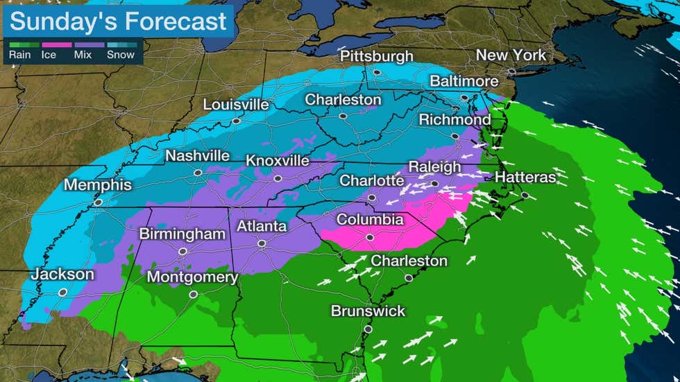
The National Weather Service is calling for snow to return to the forecast over the holiday weekend for MLK Day.
NWS forecasters from Peachtree City put the chance of snow at 90% during the evening hours on Sunday, starting with a mix of rain and snow before the evening hours, then turning into snow after 5 p.m. Thos snow showers should continue Sunday evening through 8 p.m. as the temperature drops to below freezing levels.
Wet weather is expecter for Saturday, but temperatures are predicted to be in the mid-50s and drop as the night wears on near the freezing mark.
Per the NWS, this comes as a result of a fast-moving storm coming from the northern plains starting tonight, bringing with it freezing temps and a winter storm to the upper midwest and Mississippi Valley, ultimately hitting the south through the northeast as it pushes through this weekend.
This comes after a few pleasant days in Polk County, with temperatures day up near the 60 degree mark officially, but are dipping down to 31 overnight. They are back up to 52 on Friday, and down to 32 overnight tomorrow night.
Per the forecasters, sunshine returns on Monday with a high of 43, and a low of 24.
Temperatures so far for the start of the year have been all over the place, with New Years Day providing something more spring-like then followed immediately upon that by light snow and a return to what is expected for January.
Check back for additional forecast updates on the chance for winter weather as they become available.


Leave a Reply